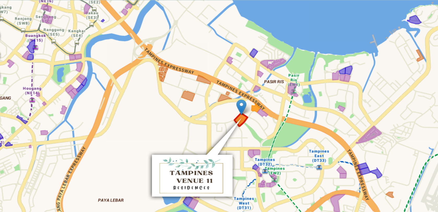
Location Map
TAMPINES NORTH
The development of Tampines North is akin to the
completion of the "Tampines Leaf".
As part of the master plan for Tampines North, a proposed
Mixed-Use Development situated on the main spine
(Tampines Boulevard Park) is one of the 5 key planning
strategies for Tampines North :
Tampines North : 5 Key Planning Strategies
Green Tapestry
Community Boulevard Park for all
Four distinctive Housing districts
Green Living Rooms at the doorsteps
Tampines North Hub.
With enhanced connections, a wide range of facilities and
amenities, as well as large green spaces with exciting
activity nodes, Tampines will be given a new lease of life -
THE NEW TAMPINES!
An Integrated Community Landmark Nestled in Greenery
A One-Stop Lifestyle Hub
Distinctive Destination
Retail Mall with shops, F&Bs, commercial uses and
outdoor recreation areas (ORAs)
Multi-Modal Transport Hub
MRT (Tampines North MRT Station) & Bus Interchange
Community Landmark
Co-location of Community Club, Hawker Centre, Public Plaza
and Green Boulevard for community events
Attractive Public Spaces
Part of the main spine (Tampines Boulevard Park) of Tampines
North, 15m wide pedestrian thoroughfare, located in the
middle of the site
Live & Play Amidst Greenery
Open to sky and lushly, continuing the experience of walking in
the park from the Tampines Boulevard Park
Amenities
TRANSPORTATION
- Tampines North MRT CRL
- DT lines
- Pasir Ris MRT Station
- Pan - Island Expressway
EDUCATION
- Angsana Primary school
- Tampines North Primary School
- Elias Park Primary school
- Tampines Meridian Junior College
RECREATIONAL
- IKEA Tampines
- Century Square
- Our Tampines Hub
- Bedok Reservoir Park
- Sun Plaza Park